Mapping the Flow of Stormwater Drainage and Why it Matters
Stormwater drainage may seem like a drip of a topic but actually, knowing where stormwater flows and retrieving that information quickly can assist in avoiding an ecological catastrophe.
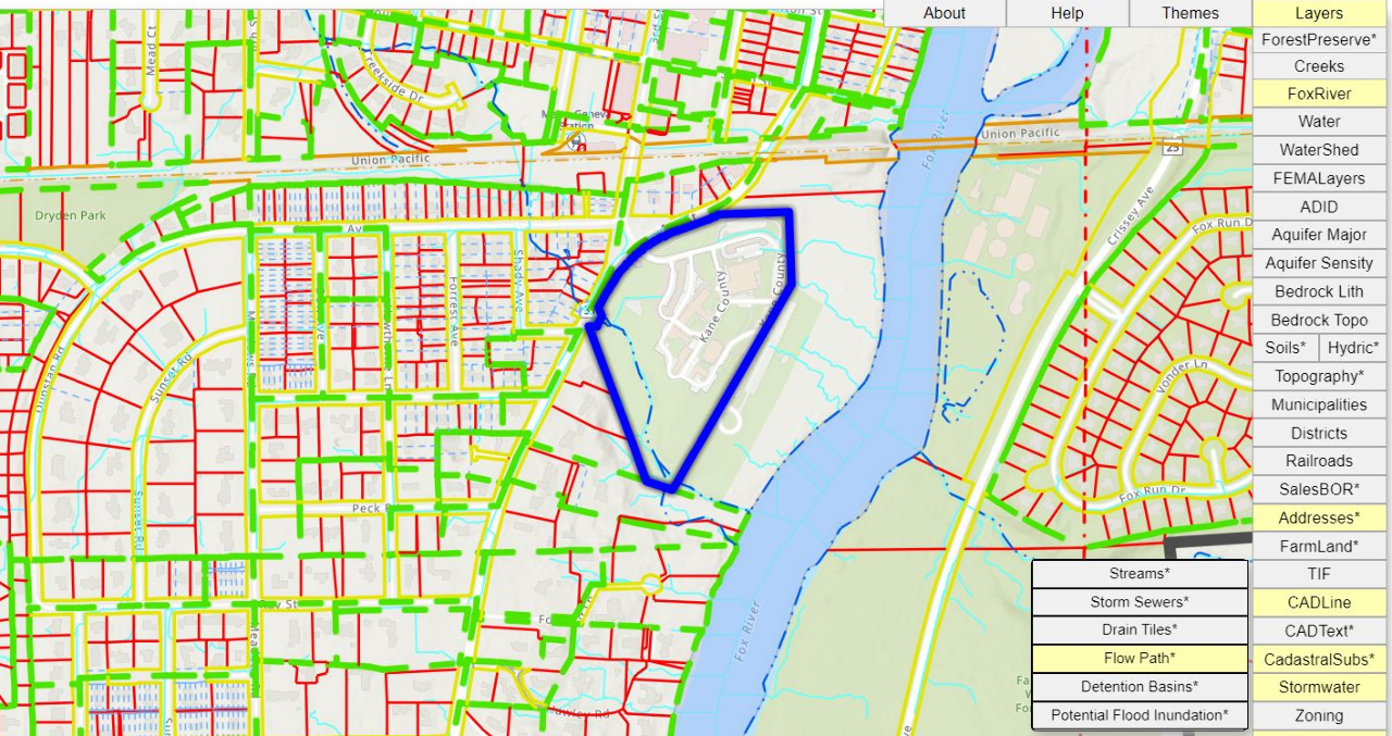
Kane County's Environmental and Water Resources Department, with the assistance of the County's GIS-Technologies Department, has created an Online Stormwater Infrastructure Map for the entire county. The inter-active map shows how drainage of rainwater or snow melt moves across the county landscape, through culverts, storm sewers, drain tiles, detention basins, streams and ultimately the river.
“We wanted to create an online mapping tool that combines information about drainage and stormwater infrastructure for the entire County into a viewable and user-friendly site," said Rob Linke, Senior Water Resources Engineer for Kane County.
The online drainage mapping can be helpful to engineers, planners, emergency responders and the general public, too.
The drainage map also has a tracing tool which can follow the predicted flow of stormwater all the way to the Fox River, a vital natural resource in Kane County and the source of drinking water for nearly 300,000 residents.
“If there was an accidental spill of some sort, first responders can use the tool to trace the path the spill is expected to take and get ahead of the situation to stop the hazard from polluting a stream or ultimately the Fox River," according to Linke.
The County's stormwater mapping includes over 2,400 miles of storm sewers and culverts and identifies an additional 150 miles of known farm drain tiles across the County.
Users can click on mapped drainage features like a detention basin to see who owns it, the year it was built and what jurisdiction (city, village, or county) it falls under.
“This is also part of our public education and outreach effort to increase residents' knowledge and interest about stormwater in their community," said Linke.
The stormwater mapping is updated continuously by the county as new information becomes available.
You can view instructions on how to use the Online Stormwater Infrastructure Map by clicking here. Click on the “Stormwater" tabs under both the Themes and Layers tabs in the top right side of the map page to access the stormwater-related information for Kane County.